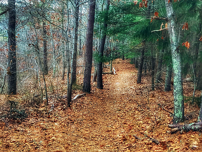
Twinings Pond Trail is a beautiful hike in any season. It’s shaded in the summer and sheltered in the winter. The trail winds through the forest which overlooks Twinings Pond, a kettle pond, and then forms a loop back to the beginning. It’s a wide trail and perfect for the whole family! A full map is at the end of the blog.
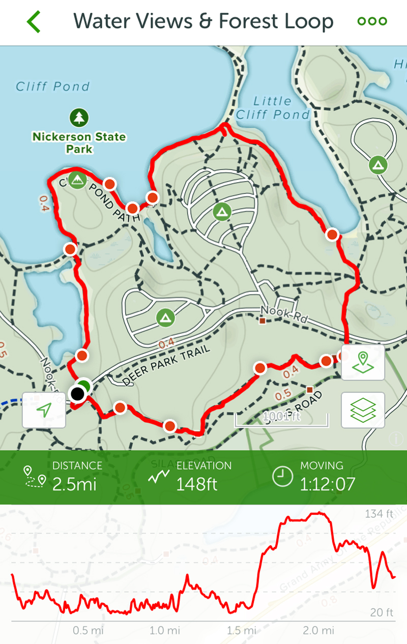
You can see the map that we recorded with the distance and elevation. The AllTrails App has been so much fun to use!
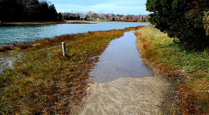
You can see the water coming in pretty fast on the Nauset Marsh Trail by the Salt Pond in Eastham and there was still almost an hour until high tide. Thank goodness there is a trail up a hill that circumvents the rising water or you would be wading pretty deep.
Make sure you always check the tides if you are hiking or walking near the ocean or the marsh. You never know just how high that water will come and you don’t want to be stuck on the wrong side!
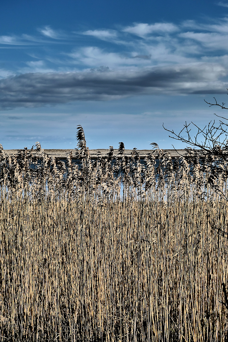
I love the hike from Doane Rock to Coast Guard Beach and the little off-shoot trail that overlooks Nauset Marsh. I thought this was such a cool photograph of the tall cattails with Nauset Marsh and Nauset Beach in the background.
And then I was editing it with my new camera and couldn’t decide which one I liked better. What do you think?
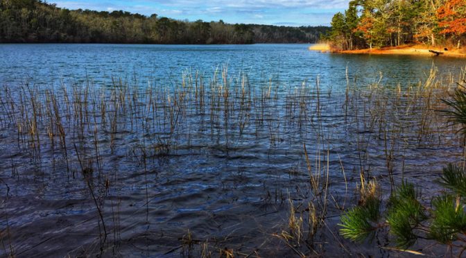
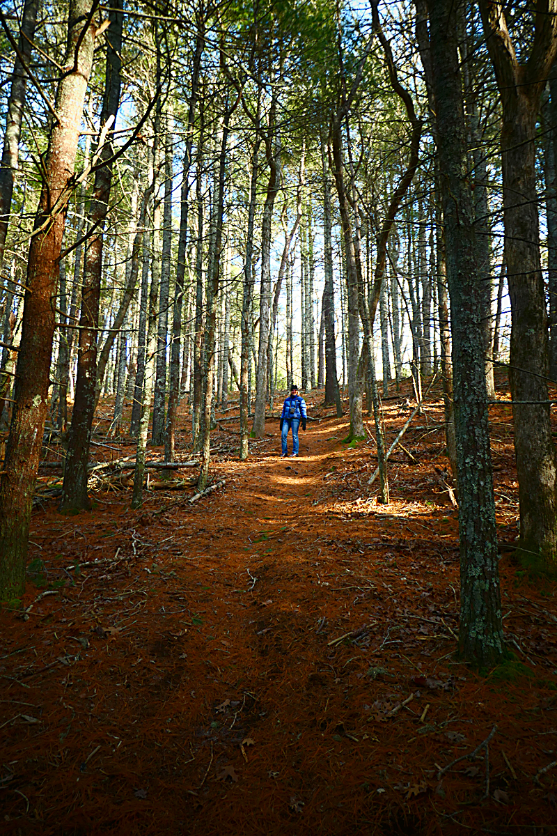
We have had so much fun with the AllTrails app which is so easy to use. We made a loop called Water Views & Forest Loop where you hike along the ponds at Nickerson State Park and then back through the pine forest. It is so beautiful. The map of the hike is at the end of the blog.
You start out hiking along the banks of Cliff Pond and Little Cliff Pond and then head back through the pine forests. It doesn’t get much prettier. You can add photos to the hike too. If you take them with your phone and download them to the app, they will pop up along the trail on the map where you took the photograph. Pretty cool, don’t you think?
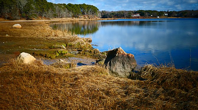
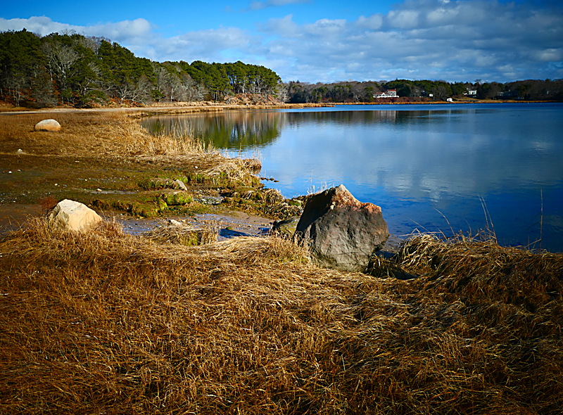
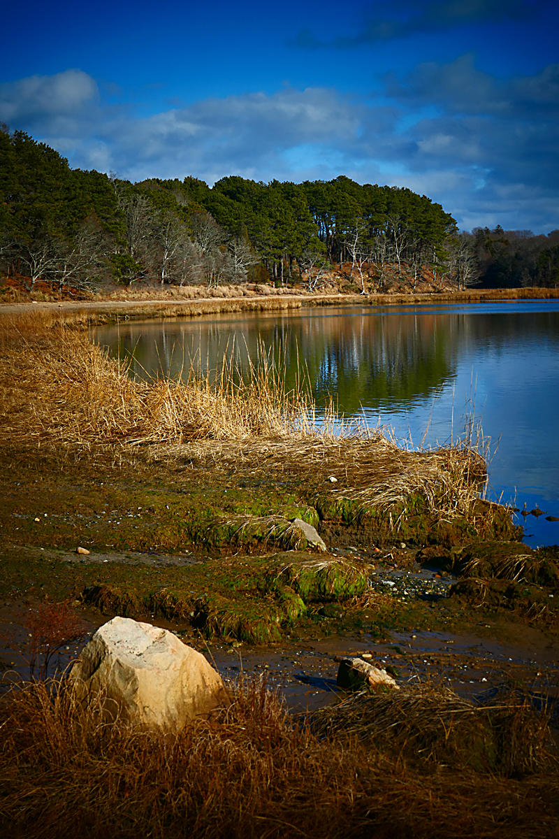
We took a hike at Kent Point in Orleans the other day and it was gorgeous with a blue, blue sky and warm temps. Kent Point has such interesting history. (There is another photograph at the end.)
“The Town acquired the Kent’s Point Conservation Area in 1988 after years of planning to preserve the property. The property was subject to a life-estate retained by the seller, Miss Charlotte Kent, who lived to be 100 years old. Her house was removed from the site after her death in 1997.
This land contains more than a mile of undeveloped shoreline. The main trail to the former Kent house site goes up the center of the property leading to a handicapped-accessible boardwalk overlooking The River and the northern portion of Pleasant Bay. ” You can also walk along the shore or on some of the smaller hikes off of the main road.
Phil and I decided to take a horizontal and a vertical photograph from the beach looking out onto Pleasant Bay. I couldn’t decide which one I liked better. What do you think?
Cape Cod daily articles on the wonderful Cape Cod places to hike, experience and photograph. A Cape Cod Outdoor Adventure Series.